A small-populated causse above the plain
Aumelas has only 624 inhabitants per 58.3 square kilometres, one of the largest and least dense communes in the area. The territory forms a plateau that peaks at 349 meters at Grand Puech and 304 meters at Montagne de la Mourre, before tilting west towards the Hérault Valley. The inhabitants are concentrated in two hamlets, the Mas d'Arnaud, where the town hall is located, and Cabriels, in the southwest; the rest of the territory is only wood, garrigues and some isolated agricultural estates, such as the Mas de Lunes or Mas Valoussière.
The name of the commune probably comes from a Gallo-Roman domain, from the Latin nickname Homullus associated with an old suffix; It is attested in ancient forms such as Omelares Castellum in 1036 or Omelaz in 1114.
Thirty minutes for a karst plateau
From the accommodation, the road measures 27.5 kilometres and runs in 30 minutes. The Aumelas plateau, very karstified, lends itself to speleology as well as to hiking. Two departmental roads, the D 139 in the north and the D 114E in the south, allow access, with wider access via the D 114 towards Cournonterral.
The Guilhem Castle and the Chapel of the Cardonnet
The castle of Aumelas was the fief of the Guilhems of Montpellier, one of the great seigneurial families of the region; a second building, the Castle-Bas d'Aumelas, completes this complex. Nearby, the chapel Saint-Martin-du-Cardonnet, built from the thermal baths of an ancient Gallo-Roman villa, has been classified as a historical monument since 1989; Saint-Sauveur chapel is not far away. The causse also preserves a dense prehistoric heritage : several dolmens, including those of Cassole and Lamouroux, two menhirs, that of the Oaks and that of the Grand Puech, and the poppidum of Peitouze, a fortified perched site that dominates the plateau.
Agricultural activity fell sharply in the commune : 41 farms were recorded in 1988, compared to 23 in 2020, for a used agricultural area increased from 1,686 to 1,506 hectares over the same period. Fifty-two establishments were located in Aumelas at the end of 2019, one quarter of them in scientific and technical activities, a rate well above the departmental average.
Bonelli eagles and karst caves
The area of Aumelas is covered by two Natura 2000 sites : the Moure and Cause Mountain of Aumelas, on 10,694 hectares, where seven species of bats have been identified, including three of Community interest, and the Moure and Aumelas Garrigues, on 9,015 hectares, which house a breeding pair of Bonelli eagles and serve as a feeding zone for the royal eagle. It is one of the few areas in the region to bring together these two emblematic raptors in one territory. A private hunt also occupies the isolated and wooded properties of the top of the plateau, while a wind power plant was built to the south, near the boundary with Villeveyrac, to enjoy the winds sweeping this bare plateau.
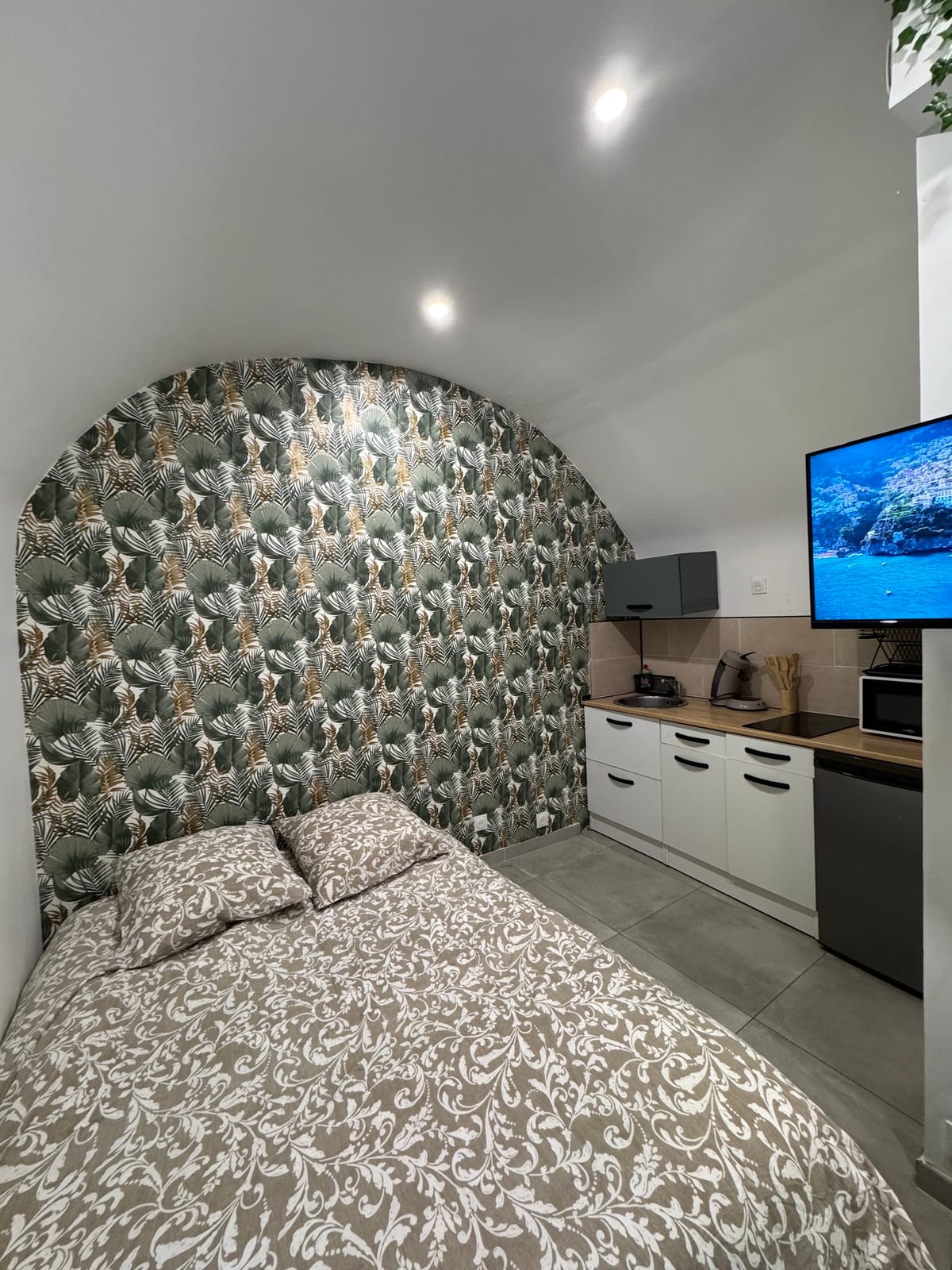
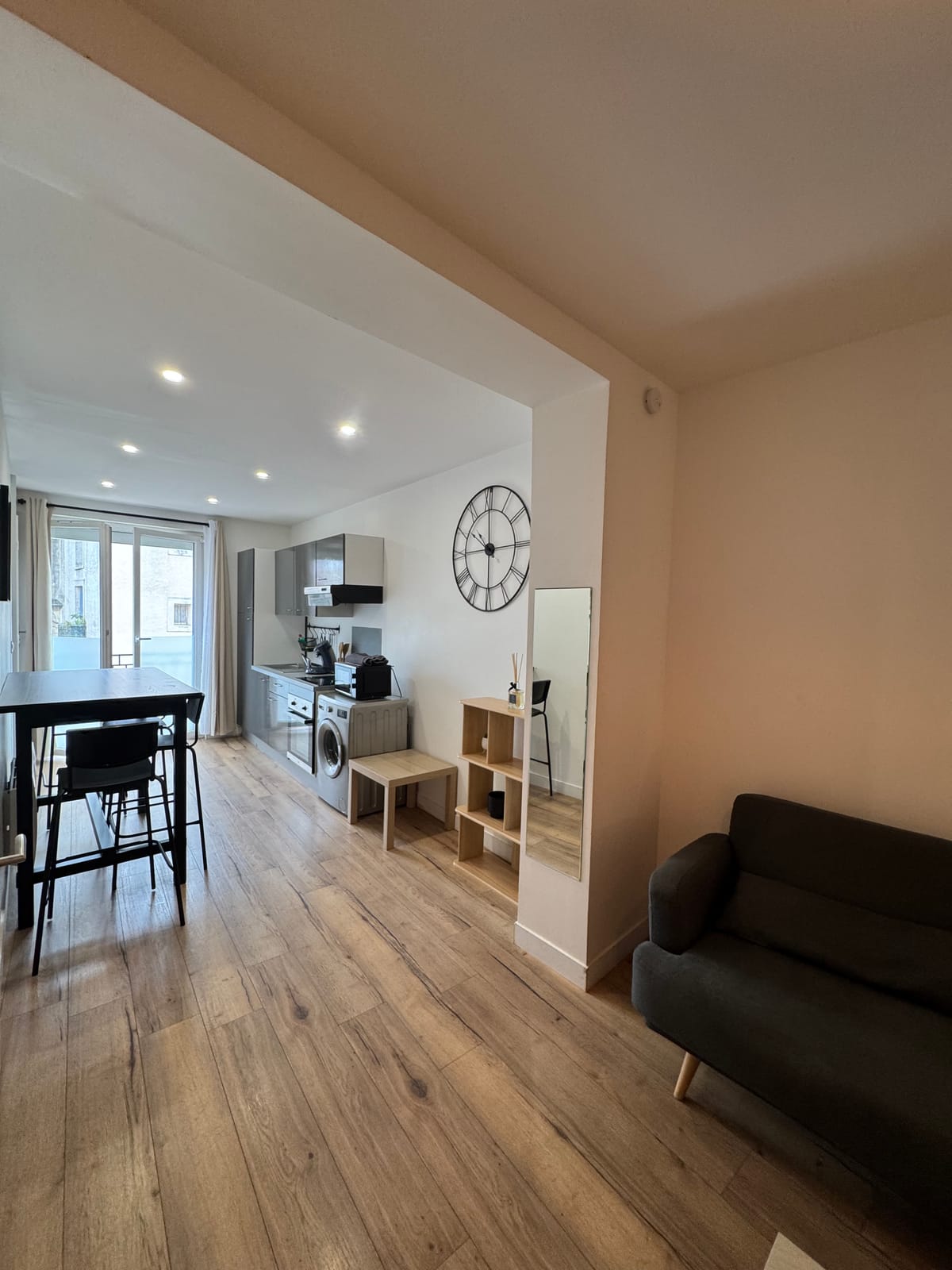
Studio or duplex before a hike on the causse
For a two-way exit on the causse, the studio large enough, with a workspace to prepare the itinerary and a kitchen equipped to return. Several, the duplex offers more space for a program combining hiking and speleology over several days, with a welcome washing machine after a dusty exit on the plateau. Both units are located at the same address, in the city centre of Saint-Jean-de-Védas, with quick access to the A709 to reach the Cournonterral area, the most direct starting point to the causse of Aumelas.
The page devoted to Cournonterral details an intermediate step towards Aumelas.