Lattes, direct neighbour by the wood of Maurin
Lattes has 17,351 inhabitants and extends south of Montpellier, in a plain cut in half by Lez. It is an immediate neighbour of Saint-Jean-de-Védas : north-east of the commune, the hamlet of the Jasse de Maurin borders the woods of Maurin, from which it is separated by the railway, and marks the boundary between the two territories. This wood also carries the natural peak of Lattes, at 26 meters above sea level, which speaks well of the flat character of this marsh country.
The very name of the commune would come from "late", the marsh. In Occitan, her name is Latas. Its territory is divided between 3 urban units, Lattes-Centre, Maurin and Boirargues, and still agricultural or natural spaces. The left bank of Lez concentrates most of the inhabitants and activities; On the right bank, the village of Maurin was built in the 1960s, with farmers repatriated from Algeria and inhabitants of Montpellier.
Lattes is also a town of companies : 2,828 establishments are located there, and important commercial areas stretch along the two roads leading from Carnon to Montpellier. A professional appointment in this sector is easily prepared from the workspace and wifi of housing.
Lattara, ancient port by the Lez
The main reason for a visit remains Lattara, one of the most important archaeological sites in France, inscribed in historical monuments (ref. Mérimée PA34000037). The site was discovered in 1963 and was founded around 525 B.C.E., probably by Etruscans. It was in the form of a port city, with an organized plan, houses on stone bases and a enclosure. The city was connected with the Greeks and then the Romans, before declining in the middle of the first century.
Less than a kilometre away, the site of the Cougourlude, occupied between 550 and 475 B.C.E., delivered Etruscan and Massaliot amphoras and dishes imported from Greece and Italy. In Lattara itself, clusters of grape seeds from the late sixth century B.C.E. and subsequent centuries show that grapes were already present in the plain.
The archaeological museum of the commune organizes exhibitions each year on the port site of Gaul, and the nearby fields of excavation are open to visits.
From the medieval port of Montpellier to Port Ariane
In the Middle Ages, Lattes served as a river port in Montpellier sur le Lez. It is partly thanks to him that Montpellier became an important shopping town in the Mediterranean from the 12th to the 15th century. This port was found in 1988, during excavations of the Mas Saint-Sauveur which preceded the urbanization of Port Ariane, with remains of Roman times and of the 15th and 17th centuries.
Today, the marina is located in the heart of this district of Port Ariane, around the Vasque. The St. Lawrence church has been protected as historical monuments since 1913 (ref. Mérimée PA00103471) : its apse, apsidiole and crows of the facade are classified. The commune also has an obelisk, identified in its heritage, and a market, the market of Lattes.
Le Méjean : pond, storks and nature house
South of Lattes-Centre, the Méjean pond is a 169.9 hectare nature reserve acquired by the Conservatoire du littoral. A house of nature, at the entrance, helps to discover the site, and a route allows you to observe migratory birds from an ornithological observatory. Storks live there permanently.
The pond is part of the Palavasian ponds, protected by the Ramsar Convention and 2 Natura 2000 sites. These lagoons serve as resting areas for pink flamingo and rare species such as dwarf tern. The Eastern Marsh and the Vasque Islands extend this waterscape.
For a shorter exit, the commune's parks offer alternatives : Parc des Quatre Saisons, Parc des Serres, Parc de Boirargues, or the Bonneterre and Montouzères health trails.
Getting there : 11 minutes by road, tram line 3 on site
From the centre of Saint-Jean-de-Védas, Lattes is 9.1 kilometres away, about 11 minutes by car. The town is easily combined with a day on the coast : it is crossed by the roads leading to the seaside resorts of Palavas-les-Flots and Carnon.
On site, the tram line 3 serves 4 stops : Soriech, Cougourlude, Lattes Centre and Boirargues. The tram also departs about 7 minutes walk from the accommodation, on line 2 : a connection thus allows to reach Lattes without car. On return, a blue area of 100 meters and free parking without any time limit of 200 meters avoid turning to park.
Studio or duplex for a visit of Lattes
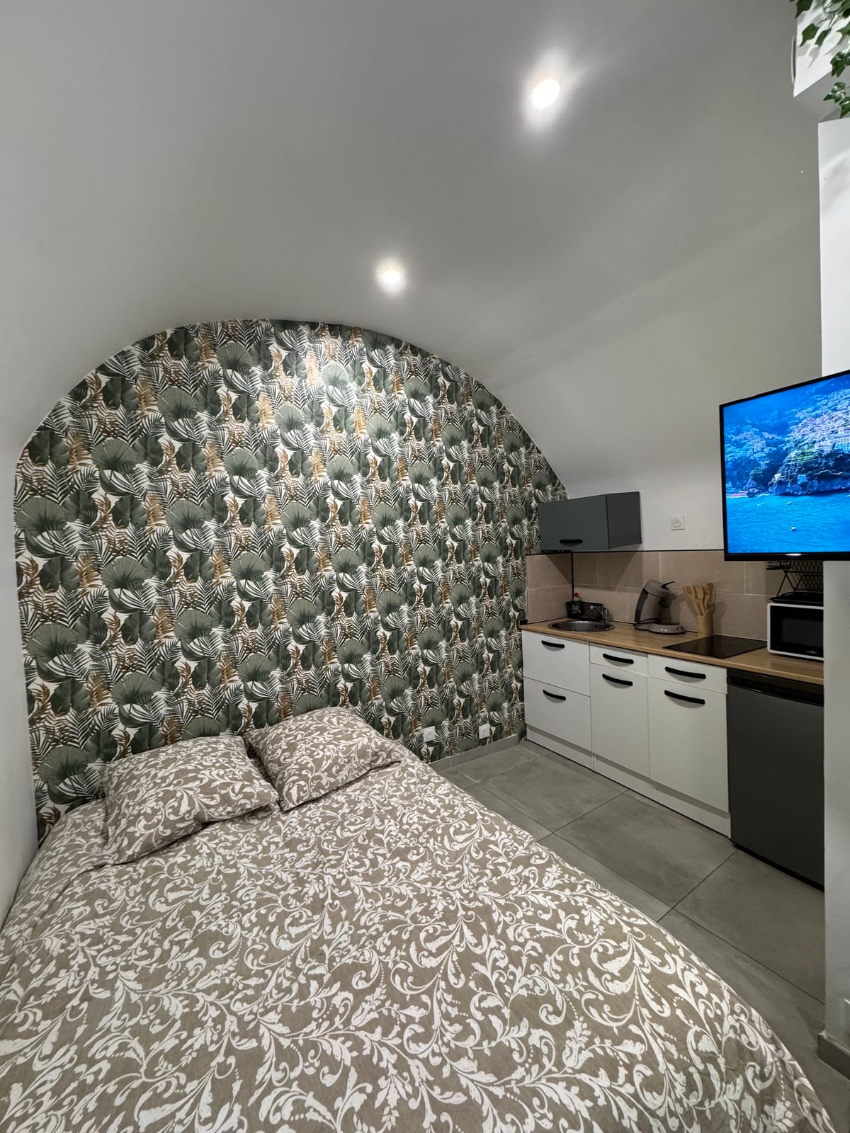
For a couple coming to Lattara and Mejean, or for a business trip in the areas of activity, the studio sufficient : double bed, equipped kitchen, workspace and connected TV.
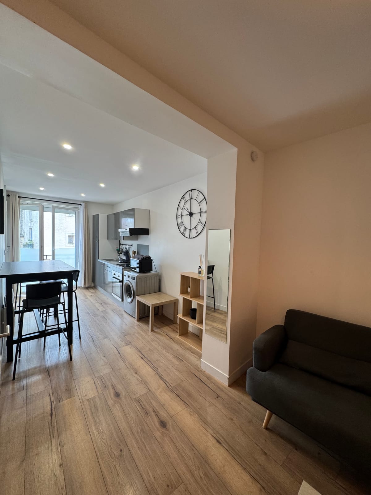
For a family that alternates archaeology, nature reserve and beach, the duplex welcomes up to 4 travelers, with two bedrooms, three beds and a washing machine. Both units share the same address, with a stand-alone arrival per key box from 5pm to 11pm and no minimum night required.
To continue towards the sea, see the pages dedicated to Palavas-les-Flots and Pérols.